my $street_poly = new mapscript::shapefileObj("stpoly", -1);
my $selected_shape = new mapscript::shapeObj(-1);
my $rectang = new mapscript::rectObj();
$rectang->{minx} = $query_shp_minx;
$rectang->{miny} = $query_shp_miny;
$rectang->{maxx} = $query_shp_maxx;
$rectang->{maxy} = $query_shp_maxy;
$st_poly_layer->{status} = $mapscript::MS_ON;
my $query_status = $st_poly_layer->queryByRect($map,$rectang);
my $result_mem = $st_poly_layer->getResult(0);
my $result_cache = $st_poly_layer->{resultcache};
$street_poly->get($result_mem->{shapeindex},$selected_shape);

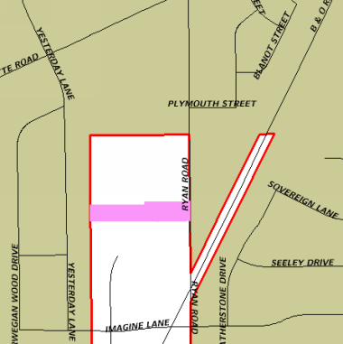
Location Map Showing All Surrounding Streets
